 array:1 [
  "RF Query: /Property?$select=ALL&$top=20&$filter=(StandardStatus in ('Active','Pending','Active Under Contract','Coming Soon') and PropertyType in ('Residential','Land')) and ListingKey eq 1108932991/Property?$select=ALL&$top=20&$filter=(StandardStatus in ('Active','Pending','Active Under Contract','Coming Soon') and PropertyType in ('Residential','Land')) and ListingKey eq 1108932991&$expand=Media/Property?$select=ALL&$top=20&$filter=(StandardStatus in ('Active','Pending','Active Under Contract','Coming Soon') and PropertyType in ('Residential','Land')) and ListingKey eq 1108932991/Property?$select=ALL&$top=20&$filter=(StandardStatus in ('Active','Pending','Active Under Contract','Coming Soon') and PropertyType in ('Residential','Land')) and ListingKey eq 1108932991&$expand=Media&$count=true" => array:2 [
    "RF Response" => Realtyna\MlsOnTheFly\Components\CloudPost\SubComponents\RFClient\SDK\RF\RFResponse {#4492
      +items: array:1 [
        0 => Realtyna\MlsOnTheFly\Components\CloudPost\SubComponents\RFClient\SDK\RF\Entities\RFProperty {#4476
          +post_id: "25385"
          +post_author: 1
          +"ListingKey": "1108932991"
          +"ListingId": "20875400"
          +"PropertyType": "Land"
          +"PropertySubType": "Unimproved Land"
          +"StandardStatus": "Active"
          +"ModificationTimestamp": "2025-03-20T01:11:04Z"
          +"RFModificationTimestamp": "2025-03-22T02:55:10Z"
          +"ListPrice": 7500000.0
          +"BathroomsTotalInteger": 0
          +"BathroomsHalf": 0
          +"BedroomsTotal": 0
          +"LotSizeArea": 50.0
          +"LivingArea": 0
          +"BuildingAreaTotal": 0
          +"City": "Greenville"
          +"PostalCode": "75401"
          +"UnparsedAddress": "0000 Highway 380, Greenville, Texas 75401"
          +"Coordinates": array:2 [
            0 => -96.156321
            1 => 33.136889
          ]
          +"Latitude": 33.136889
          +"Longitude": -96.156321
          +"YearBuilt": 0
          +"InternetAddressDisplayYN": true
          +"FeedTypes": "IDX"
          +"ListAgentFullName": "D'Anna Bates"
          +"ListOfficeName": "McBrayer Realty Services, Inc."
          +"ListAgentMlsId": "0682958"
          +"ListOfficeMlsId": "MMRS01C"
          +"OriginatingSystemName": "NTR"
          +"PublicRemarks": """
            Look no further!   Great development property! Frontage on FM 1570 and Highway 380.  High traffic area,  Minutes from I-30, Hwy 66 and Hwy 69.  \r\n
            FM 1570 right of way has been taken for four lanes.  Caddo Basin water along Hwy 380.  Electricity at west boundary. WILL SUBDIVIDE!
            """
          +"AttributionContact": "972-235-7400"
          +"CLIP": 4542262647
          +"Country": "US"
          +"CountyOrParish": "Hunt"
          +"CreationDate": "2025-03-22T02:55:09.926871+00:00"
          +"CurrentUse": "Agricultural"
          +"Directions": "From Greenville go west on 380 and property is on the left of the intersection of 380 and FM1570 On the southwest corner"
          +"DocumentsAvailable": "Survey"
          +"ElementarySchool": "Carver"
          +"ElementarySchoolDistrict": "Greenville ISD"
          +"Fencing": "None"
          +"HighSchool": "Greenville"
          +"HighSchoolDistrict": "Greenville ISD"
          +"RFTransactionType": "For Sale"
          +"InternetAutomatedValuationDisplayYN": true
          +"InternetConsumerCommentYN": true
          +"InternetEntireListingDisplayYN": true
          +"ListAgentDirectPhone": "214-491-7842"
          +"ListAgentEmail": "danna.driggersrealestate@hotmail.com"
          +"ListAgentFirstName": "D'Anna"
          +"ListAgentKey": "20436979"
          +"ListAgentKeyNumeric": "20436979"
          +"ListAgentLastName": "Bates"
          +"ListOfficeKey": "4501459"
          +"ListOfficeKeyNumeric": "4501459"
          +"ListOfficePhone": "972-235-7400"
          +"ListingAgreement": "Exclusive Right To Sell"
          +"ListingContractDate": "2025-03-19"
          +"ListingKeyNumeric": 1108932991
          +"ListingTerms": "Cash, Conventional"
          +"LockBoxType": "None"
          +"LotFeatures": "Acreage, Agricultural"
          +"LotSizeAcres": 50.0
          +"LotSizeSource": "Assessor"
          +"LotSizeSquareFeet": 2178000.0
          +"MajorChangeTimestamp": "2025-03-19T09:53:06Z"
          +"MiddleOrJuniorSchool": "Greenville"
          +"MlsStatus": "Active"
          +"OccupantType": "Owner"
          +"OriginalListPrice": 7500000.0
          +"OriginatingSystemKey": "452689536"
          +"OwnerName": "Members Investment"
          +"ParcelNumber": "227563"
          +"PhotosChangeTimestamp": "2025-03-19T14:53:45Z"
          +"PhotosCount": 3
          +"Possession": "Close Of Escrow"
          +"PossibleUse": "Agricultural, Commercial, Development"
          +"RoadFrontageType": "Highway,All Weather Road"
          +"RoadSurfaceType": "Asphalt"
          +"ShowingContactPhone": "214-491-7842"
          +"ShowingContactType": "Agent"
          +"ShowingInstructions": "You can see property from road and we have a survey.  DO NOT drive on property."
          +"ShowingRequirements": "Go Direct"
          +"StateOrProvince": "TX"
          +"StatusChangeTimestamp": "2025-03-19T09:53:06Z"
          +"StreetName": "Highway 380"
          +"StreetNumber": "0000"
          +"SubdivisionName": "Braziel John"
          +"SyndicateTo": "Homes.com,IDX Sites,Realtor.com,RPR,Syndication Allowed"
          +"TaxAnnualAmount": "153.0"
          +"TaxLegalDescription": "A0072 BRAZIEL JOHN, TRACT 2-2, ACRES 50.0"
          +"VirtualTourURLUnbranded": "https://www.propertypanorama.com/instaview/ntreis/20875400"
          +"ZoningDescription": "Not zoned"
          +"Restrictions": "Development Restriction,Easement(s)"
          +"HumanModifiedYN": false
          +"GarageDimensions": ",,"
          +"OriginatingSystemSubName": "NTR_NTREIS"
          +"@odata.id": "https://api.realtyfeed.com/reso/odata/Property('1108932991')"
          +"provider_name": "NTREIS"
          +"short_address": "Greenville, Texas 75401, US"
          +"RecordSignature": 222507107
          +"UniversalParcelId": "urn:reso:upi:2.0:US:48231:227563"
          +"CountrySubdivision": "48231"
          +"Media": array:3 [
            0 => array:58 [
              "Order" => 1
              "ImageOf" => "Community"
              "ListAOR" => "Collin County Association of Realtors Inc"
              "MediaKey" => "2003851492424"
              "MediaURL" => "https://dx41nk9nsacii.cloudfront.net/cdn/119/1108932991/3347a4e10d70c62c6ff08aae7a6f3841.webp"
              "ClassName" => null
              "MediaHTML" => null
              "MediaSize" => 357521
              "MediaType" => "webp"
              "Thumbnail" => "https://dx41nk9nsacii.cloudfront.net/cdn/119/1108932991/thumbnail-3347a4e10d70c62c6ff08aae7a6f3841.webp"
              "ImageWidth" => null
              "Permission" => null
              "ImageHeight" => null
              "MediaStatus" => null
              "SyndicateTo" => "Homes.com,IDX Sites,Realtor.com,RPR,Syndication Allowed"
              "ListAgentKey" => "20436979"
              "PropertyType" => "Land"
              "ResourceName" => "Property"
              "ListOfficeKey" => "4501459"
              "MediaCategory" => "Photo"
              "MediaObjectID" => "IMG_0319.jpeg"
              "OffMarketDate" => null
              "X_MediaStream" => null
              "SourceSystemID" => "TRESTLE"
              "StandardStatus" => "Active"
              "HumanModifiedYN" => false
              "ListOfficeMlsId" => null
              "LongDescription" => "View of road featuring traffic signs"
              "MediaAlteration" => null
              "MediaKeyNumeric" => 2003851492424
              "PropertySubType" => "Unimproved Land"
              "RecordSignature" => 2107105005
              "PreferredPhotoYN" => null
              "ResourceRecordID" => "20875400"
              "ShortDescription" => null
              "SourceSystemName" => null
              "ChangedByMemberID" => null
              "ListingPermission" => null
              "PermissionPrivate" => null
              "ResourceRecordKey" => "1108932991"
              "ChangedByMemberKey" => null
              "MediaClassification" => "PHOTO"
              "OriginatingSystemID" => null
              "ImageSizeDescription" => null
              "SourceSystemMediaKey" => null
              "ModificationTimestamp" => "2025-03-19T14:53:25.777-00:00"
              "OriginatingSystemName" => "NTR"
              "MediaStatusDescription" => null
              "OriginatingSystemSubName" => "NTR_NTREIS"
              "ResourceRecordKeyNumeric" => 1108932991
              "ChangedByMemberKeyNumeric" => null
              "OriginatingSystemMediaKey" => "452694819"
              "PropertySubTypeAdditional" => "Unimproved Land"
              "MediaModificationTimestamp" => "2025-03-19T14:53:25.777-00:00"
              "SourceSystemResourceRecordKey" => null
              "InternetEntireListingDisplayYN" => true
              "OriginatingSystemResourceRecordId" => null
              "OriginatingSystemResourceRecordKey" => "452689536"
            ]
            1 => array:58 [
              "Order" => 2
              "ImageOf" => "Other"
              "ListAOR" => "Collin County Association of Realtors Inc"
              "MediaKey" => "2003851492425"
              "MediaURL" => "https://dx41nk9nsacii.cloudfront.net/cdn/119/1108932991/d69d6c8f470deac2ce8d7a8df1cdf8e5.webp"
              "ClassName" => null
              "MediaHTML" => null
              "MediaSize" => 502982
              "MediaType" => "webp"
              "Thumbnail" => "https://dx41nk9nsacii.cloudfront.net/cdn/119/1108932991/thumbnail-d69d6c8f470deac2ce8d7a8df1cdf8e5.webp"
              "ImageWidth" => null
              "Permission" => null
              "ImageHeight" => null
              "MediaStatus" => null
              "SyndicateTo" => "Homes.com,IDX Sites,Realtor.com,RPR,Syndication Allowed"
              "ListAgentKey" => "20436979"
              "PropertyType" => "Land"
              "ResourceName" => "Property"
              "ListOfficeKey" => "4501459"
              "MediaCategory" => "Photo"
              "MediaObjectID" => "IMG_0320.jpeg"
              "OffMarketDate" => null
              "X_MediaStream" => null
              "SourceSystemID" => "TRESTLE"
              "StandardStatus" => "Active"
              "HumanModifiedYN" => false
              "ListOfficeMlsId" => null
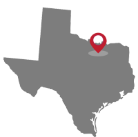
              "LongDescription" => "Map location"
              "MediaAlteration" => null
              "MediaKeyNumeric" => 2003851492425
              "PropertySubType" => "Unimproved Land"
              "RecordSignature" => 2107105005
              "PreferredPhotoYN" => null
              "ResourceRecordID" => "20875400"
              "ShortDescription" => null
              "SourceSystemName" => null
              "ChangedByMemberID" => null
              "ListingPermission" => null
              "PermissionPrivate" => null
              "ResourceRecordKey" => "1108932991"
              "ChangedByMemberKey" => null
              "MediaClassification" => "PHOTO"
              "OriginatingSystemID" => null
              "ImageSizeDescription" => null
              "SourceSystemMediaKey" => null
              "ModificationTimestamp" => "2025-03-19T14:53:25.777-00:00"
              "OriginatingSystemName" => "NTR"
              "MediaStatusDescription" => null
              "OriginatingSystemSubName" => "NTR_NTREIS"
              "ResourceRecordKeyNumeric" => 1108932991
              "ChangedByMemberKeyNumeric" => null
              "OriginatingSystemMediaKey" => "452694820"
              "PropertySubTypeAdditional" => "Unimproved Land"
              "MediaModificationTimestamp" => "2025-03-19T14:53:25.777-00:00"
              "SourceSystemResourceRecordKey" => null
              "InternetEntireListingDisplayYN" => true
              "OriginatingSystemResourceRecordId" => null
              "OriginatingSystemResourceRecordKey" => "452689536"
            ]
            2 => array:58 [
              "Order" => 3
              "ImageOf" => "Other"
              "ListAOR" => "Collin County Association of Realtors Inc"
              "MediaKey" => "2003851517692"
              "MediaURL" => "https://dx41nk9nsacii.cloudfront.net/cdn/119/1108932991/b2301fd92fb2423621874562ba88fa68.webp"
              "ClassName" => null
              "MediaHTML" => null
              "MediaSize" => 418705
              "MediaType" => "webp"
              "Thumbnail" => "https://dx41nk9nsacii.cloudfront.net/cdn/119/1108932991/thumbnail-b2301fd92fb2423621874562ba88fa68.webp"
              "ImageWidth" => null
              "Permission" => null
              "ImageHeight" => null
              "MediaStatus" => null
              "SyndicateTo" => "Homes.com,IDX Sites,Realtor.com,RPR,Syndication Allowed"
              "ListAgentKey" => "20436979"
              "PropertyType" => "Land"
              "ResourceName" => "Property"
              "ListOfficeKey" => "4501459"
              "MediaCategory" => "Photo"
              "MediaObjectID" => "survey members investment 50 ac.jpg"
              "OffMarketDate" => null
              "X_MediaStream" => null
              "SourceSystemID" => "TRESTLE"
              "StandardStatus" => "Active"
              "HumanModifiedYN" => false
              "ListOfficeMlsId" => null
              "LongDescription" => "Map location"
              "MediaAlteration" => null
              "MediaKeyNumeric" => 2003851517692
              "PropertySubType" => "Unimproved Land"
              "RecordSignature" => 2107105005
              "PreferredPhotoYN" => null
              "ResourceRecordID" => "20875400"
              "ShortDescription" => null
              "SourceSystemName" => null
              "ChangedByMemberID" => null
              "ListingPermission" => null
              "PermissionPrivate" => null
              "ResourceRecordKey" => "1108932991"
              "ChangedByMemberKey" => null
              "MediaClassification" => "PHOTO"
              "OriginatingSystemID" => null
              "ImageSizeDescription" => null
              "SourceSystemMediaKey" => null
              "ModificationTimestamp" => "2025-03-19T14:53:25.777-00:00"
              "OriginatingSystemName" => "NTR"
              "MediaStatusDescription" => null
              "OriginatingSystemSubName" => "NTR_NTREIS"
              "ResourceRecordKeyNumeric" => 1108932991
              "ChangedByMemberKeyNumeric" => null
              "OriginatingSystemMediaKey" => "452695754"
              "PropertySubTypeAdditional" => "Unimproved Land"
              "MediaModificationTimestamp" => "2025-03-19T14:53:25.777-00:00"
              "SourceSystemResourceRecordKey" => null
              "InternetEntireListingDisplayYN" => true
              "OriginatingSystemResourceRecordId" => null
              "OriginatingSystemResourceRecordKey" => "452689536"
            ]
          ]
          +"ID": "25385"
        }
      ]
      +success: true
      +page_size: 1
      +page_count: 1
      +count: 1
      +after_key: ""
    }
    "RF Response Time" => "0.09 seconds"
  ]
]


