 array:1 [
  "RF Query: /Property?$select=ALL&$top=20&$filter=(StandardStatus in ('Active','Pending','Active Under Contract','Coming Soon') and PropertyType in ('Residential','Land')) and ListingKey eq 1093558961/Property?$select=ALL&$top=20&$filter=(StandardStatus in ('Active','Pending','Active Under Contract','Coming Soon') and PropertyType in ('Residential','Land')) and ListingKey eq 1093558961&$expand=Media/Property?$select=ALL&$top=20&$filter=(StandardStatus in ('Active','Pending','Active Under Contract','Coming Soon') and PropertyType in ('Residential','Land')) and ListingKey eq 1093558961/Property?$select=ALL&$top=20&$filter=(StandardStatus in ('Active','Pending','Active Under Contract','Coming Soon') and PropertyType in ('Residential','Land')) and ListingKey eq 1093558961&$expand=Media&$count=true" => array:2 [
    "RF Response" => Realtyna\MlsOnTheFly\Components\CloudPost\SubComponents\RFClient\SDK\RF\RFResponse {#4491
      +items: array:1 [
        0 => Realtyna\MlsOnTheFly\Components\CloudPost\SubComponents\RFClient\SDK\RF\Entities\RFProperty {#4475
          +post_id: "44966"
          +post_author: 1
          +"ListingKey": "1093558961"
          +"ListingId": "20769977"
          +"PropertyType": "Land"
          +"PropertySubType": "Unimproved Land"
          +"StandardStatus": "Active"
          +"ModificationTimestamp": "2025-04-22T19:06:13Z"
          +"RFModificationTimestamp": "2025-04-22T20:15:10.614734+00:00"
          +"ListPrice": 9000.0
          +"BathroomsTotalInteger": 0
          +"BathroomsHalf": 0
          +"BedroomsTotal": 0
          +"LotSizeArea": 0.27
          +"LivingArea": 0
          +"BuildingAreaTotal": 0
          +"City": "Brownwood"
          +"PostalCode": "76801"
          +"UnparsedAddress": "N/a Lanyard Way, Brownwood, Texas 76801"
          +"Coordinates": array:2 [
            0 => -99.0412977
            1 => 31.8005674
          ]
          +"Latitude": 31.8005674
          +"Longitude": -99.0412977
          +"YearBuilt": 0
          +"InternetAddressDisplayYN": true
          +"FeedTypes": "IDX"
          +"ListAgentFullName": "Brandon Shearin"
          +"ListOfficeName": "Southern Hills Realty"
          +"ListAgentMlsId": "0691606"
          +"ListOfficeMlsId": "STHR01"
          +"OriginatingSystemName": "NTR"
          +"PublicRemarks": "Ready to build, prime location!"
          +"AssociationFee": "360.0"
          +"AssociationFeeFrequency": "Annually"
          +"AssociationFeeIncludes": "All Facilities,Maintenance Structure"
          +"AssociationName": "Hideout"
          +"AssociationPhone": "325784000"
          +"AttributionContact": "214-817-0880"
          +"Country": "US"
          +"CountyOrParish": "Brown"
          +"CreationDate": "2024-11-04T15:37:57.592872+00:00"
          +"CumulativeDaysOnMarket": 169
          +"DevelopmentStatus": "Other"
          +"Directions": "Take Highway 279 and follow GPS to Hideout"
          +"ElementarySchool": "Northwest"
          +"ElementarySchoolDistrict": "Brownwood ISD"
          +"HighSchool": "Brownwood"
          +"HighSchoolDistrict": "Brownwood ISD"
          +"HumanModifiedYN": true
          +"RFTransactionType": "For Sale"
          +"InternetAutomatedValuationDisplayYN": true
          +"InternetConsumerCommentYN": true
          +"InternetEntireListingDisplayYN": true
          +"ListAgentAOR": "Metrotex Association of Realtors Inc"
          +"ListAgentDirectPhone": "972-821-9693"
          +"ListAgentEmail": "brandon.s@southernhillshomebuyers.com"
          +"ListAgentFirstName": "Brandon"
          +"ListAgentKey": "20481306"
          +"ListAgentKeyNumeric": "20481306"
          +"ListAgentLastName": "Shearin"
          +"ListAgentMiddleName": "B"
          +"ListOfficeKey": "4511551"
          +"ListOfficeKeyNumeric": "4511551"
          +"ListOfficePhone": "214-817-0880"
          +"ListingAgreement": "Exclusive Right To Sell"
          +"ListingContractDate": "2024-11-04"
          +"ListingKeyNumeric": 1093558961
          +"LockBoxType": "None"
          +"LotFeatures": "Cul-De-Sac,Many Trees"
          +"LotSizeAcres": 0.27
          +"LotSizeSquareFeet": 11761.2
          +"MajorChangeTimestamp": "2025-04-22T14:06:05Z"
          +"MiddleOrJuniorSchool": "Brownwood"
          +"MlsStatus": "Active"
          +"OriginalListPrice": 14000.0
          +"OriginatingSystemKey": "446326581"
          +"OwnerName": "see tax"
          +"ParcelNumber": "000020043506"
          +"PhotosChangeTimestamp": "2024-11-04T15:40:31Z"
          +"PhotosCount": 2
          +"Possession": "Close Of Escrow"
          +"PriceChangeTimestamp": "2025-04-22T14:06:05Z"
          +"RoadFrontageType": "All Weather Road"
          +"StateOrProvince": "TX"
          +"StatusChangeTimestamp": "2024-11-04T09:36:18Z"
          +"StreetName": "Lanyard"
          +"StreetNumber": "n/a"
          +"StreetSuffix": "Way"
          +"SubdivisionName": "Kings Point Cove"
          +"SyndicateTo": "Homes.com,IDX Sites,Realtor.com,RPR,Syndication Allowed"
          +"TaxAnnualAmount": "305.0"
          +"TaxLegalDescription": "KING'S POINT COVE UNIT 2, LOT 665, ACRES 0.27"
          +"Utilities": "Electricity Available"
          +"ZoningDescription": "Residential"
          +"Restrictions": "Deed Restrictions"
          +"GarageDimensions": ",,"
          +"OriginatingSystemSubName": "NTR_NTREIS"
          +"@odata.id": "https://api.realtyfeed.com/reso/odata/Property('1093558961')"
          +"provider_name": "NTREIS"
          +"RecordSignature": 771572924
          +"UniversalParcelId": "urn:reso:upi:2.0:US:48049:000020043506"
          +"CountrySubdivision": "48049"
          +"Media": array:2 [
            0 => array:57 [
              "Order" => 1
              "ImageOf" => "Aerial View"
              "ListAOR" => "Metrotex Association of Realtors Inc"
              "MediaKey" => "2003613284900"
              "MediaURL" => "https://dx41nk9nsacii.cloudfront.net/cdn/119/1093558961/755e694a76774c3ac1cc1cd4e7eb115b.webp"
              "ClassName" => null
              "MediaHTML" => null
              "MediaSize" => 419352
              "MediaType" => "webp"
              "Thumbnail" => "https://dx41nk9nsacii.cloudfront.net/cdn/119/1093558961/thumbnail-755e694a76774c3ac1cc1cd4e7eb115b.webp"
              "ImageWidth" => null
              "Permission" => null
              "ImageHeight" => null
              "MediaStatus" => null
              "SyndicateTo" => "Homes.com,IDX Sites,Realtor.com,RPR,Syndication Allowed"
              "ListAgentKey" => "20481306"
              "PropertyType" => "Land"
              "ResourceName" => "Property"
              "ListOfficeKey" => "4511551"
              "MediaCategory" => "Photo"
              "MediaObjectID" => "GetMedia.jpg"
              "OffMarketDate" => null
              "X_MediaStream" => null
              "SourceSystemID" => "TRESTLE"
              "StandardStatus" => "Active"
              "HumanModifiedYN" => false
              "ListOfficeMlsId" => "STHR01"
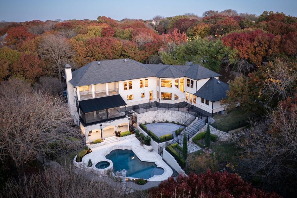
              "LongDescription" => "Aerial view at dusk with a water view"
              "MediaAlteration" => null
              "MediaKeyNumeric" => 2003613284900
              "PropertySubType" => "Unimproved Land"
              "RecordSignature" => -565939321
              "PreferredPhotoYN" => null
              "ResourceRecordID" => "20769977"
              "ShortDescription" => null
              "SourceSystemName" => null
              "ChangedByMemberID" => null
              "ListingPermission" => null
              "PermissionPrivate" => null
              "ResourceRecordKey" => "1093558961"
              "ChangedByMemberKey" => null
              "MediaClassification" => "PHOTO"
              "OriginatingSystemID" => null
              "ImageSizeDescription" => null
              "SourceSystemMediaKey" => null
              "ModificationTimestamp" => "2024-11-04T15:40:08.823-00:00"
              "OriginatingSystemName" => "NTR"
              "MediaStatusDescription" => null
              "OriginatingSystemSubName" => "NTR_NTREIS"
              "ResourceRecordKeyNumeric" => 1093558961
              "ChangedByMemberKeyNumeric" => null
              "OriginatingSystemMediaKey" => "446326704"
              "PropertySubTypeAdditional" => "Unimproved Land"
              "MediaModificationTimestamp" => "2024-11-04T15:40:08.823-00:00"
              "InternetEntireListingDisplayYN" => true
              "OriginatingSystemResourceRecordId" => null
              "OriginatingSystemResourceRecordKey" => "446326581"
            ]
            1 => array:57 [
              "Order" => 2
              "ImageOf" => "Community"
              "ListAOR" => "Metrotex Association of Realtors Inc"
              "MediaKey" => "2003613284901"
              "MediaURL" => "https://dx41nk9nsacii.cloudfront.net/cdn/119/1093558961/2d2a3fb9946938658eb175afba06a4d7.webp"
              "ClassName" => null
              "MediaHTML" => null
              "MediaSize" => 94417
              "MediaType" => "webp"
              "Thumbnail" => "https://dx41nk9nsacii.cloudfront.net/cdn/119/1093558961/thumbnail-2d2a3fb9946938658eb175afba06a4d7.webp"
              "ImageWidth" => null
              "Permission" => null
              "ImageHeight" => null
              "MediaStatus" => null
              "SyndicateTo" => "Homes.com,IDX Sites,Realtor.com,RPR,Syndication Allowed"
              "ListAgentKey" => "20481306"
              "PropertyType" => "Land"
              "ResourceName" => "Property"
              "ListOfficeKey" => "4511551"
              "MediaCategory" => "Photo"
              "MediaObjectID" => "GetMedia (1).jpg"
              "OffMarketDate" => null
              "X_MediaStream" => null
              "SourceSystemID" => "TRESTLE"
              "StandardStatus" => "Active"
              "HumanModifiedYN" => false
              "ListOfficeMlsId" => "STHR01"
              "LongDescription" => "View of community with a lawn"
              "MediaAlteration" => null
              "MediaKeyNumeric" => 2003613284901
              "PropertySubType" => "Unimproved Land"
              "RecordSignature" => -565939321
              "PreferredPhotoYN" => null
              "ResourceRecordID" => "20769977"
              "ShortDescription" => null
              "SourceSystemName" => null
              "ChangedByMemberID" => null
              "ListingPermission" => null
              "PermissionPrivate" => null
              "ResourceRecordKey" => "1093558961"
              "ChangedByMemberKey" => null
              "MediaClassification" => "PHOTO"
              "OriginatingSystemID" => null
              "ImageSizeDescription" => null
              "SourceSystemMediaKey" => null
              "ModificationTimestamp" => "2024-11-04T15:40:08.823-00:00"
              "OriginatingSystemName" => "NTR"
              "MediaStatusDescription" => null
              "OriginatingSystemSubName" => "NTR_NTREIS"
              "ResourceRecordKeyNumeric" => 1093558961
              "ChangedByMemberKeyNumeric" => null
              "OriginatingSystemMediaKey" => "446326705"
              "PropertySubTypeAdditional" => "Unimproved Land"
              "MediaModificationTimestamp" => "2024-11-04T15:40:08.823-00:00"
              "InternetEntireListingDisplayYN" => true
              "OriginatingSystemResourceRecordId" => null
              "OriginatingSystemResourceRecordKey" => "446326581"
            ]
          ]
          +"ID": "44966"
        }
      ]
      +success: true
      +page_size: 1
      +page_count: 1
      +count: 1
      +after_key: ""
    }
    "RF Response Time" => "0.09 seconds"
  ]
]


