array:1 [
"RF Query: /Property?$select=ALL&$top=20&$filter=(StandardStatus in ('Active','Pending','Active Under Contract','Coming Soon') and PropertyType in ('Residential','Land')) and ListingKey eq 1032193019/Property?$select=ALL&$top=20&$filter=(StandardStatus in ('Active','Pending','Active Under Contract','Coming Soon') and PropertyType in ('Residential','Land')) and ListingKey eq 1032193019&$expand=Media/Property?$select=ALL&$top=20&$filter=(StandardStatus in ('Active','Pending','Active Under Contract','Coming Soon') and PropertyType in ('Residential','Land')) and ListingKey eq 1032193019/Property?$select=ALL&$top=20&$filter=(StandardStatus in ('Active','Pending','Active Under Contract','Coming Soon') and PropertyType in ('Residential','Land')) and ListingKey eq 1032193019&$expand=Media&$count=true" => array:2 [
"RF Response" => Realtyna\MlsOnTheFly\Components\CloudPost\SubComponents\RFClient\SDK\RF\RFResponse {#4491
+items: array:1 [
0 => Realtyna\MlsOnTheFly\Components\CloudPost\SubComponents\RFClient\SDK\RF\Entities\RFProperty {#4475
+post_id: "50625"
+post_author: 1
+"ListingKey": "1032193019"
+"ListingId": "20232357"
+"PropertyType": "Land"
+"PropertySubType": "Unimproved Land"
+"StandardStatus": "Active"
+"ModificationTimestamp": "2024-12-20T11:24:30Z"
+"RFModificationTimestamp": "2024-12-20T11:25:55.841800+00:00"
+"ListPrice": 65000.0
+"BathroomsTotalInteger": 0
+"BathroomsHalf": 0
+"BedroomsTotal": 0
+"LotSizeArea": 4.15
+"LivingArea": 0
+"BuildingAreaTotal": 0
+"City": "Ringgold"
+"PostalCode": "76261"
+"UnparsedAddress": "Lot 7 81 Highway, Ringgold, Texas 76261"
+"Coordinates": array:2 [
0 => -97.9366834
1 => 33.78457802
]
+"Latitude": 33.78457802
+"Longitude": -97.9366834
+"YearBuilt": 0
+"InternetAddressDisplayYN": true
+"FeedTypes": "IDX"
+"ListAgentFullName": "David Claborn"
+"ListOfficeName": "David Claborn, Broker"
+"ListAgentMlsId": "0348228"
+"ListOfficeMlsId": "CLAO01"
+"OriginatingSystemName": "NTR"
+"PublicRemarks": """
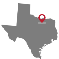
Stonewood Ranch is a proposed 13-lot subdivision in northern Montague County. The property is located approximately 2 miles south of Ringgold, Texas, at the southeast corner of Hwy 81 and Leeper Rd. Sites in the proposed development consist of tracts ranging in size from 2.5 acres to 4.5 acres and 6.5 acres respectively The site is gently sloping with nice building sites available. Buyer and Buyer's Agent are responsible for verifying all listing and property information. The listing Agent is a principal in the transaction.\r\n
\r\n
See Documents for Plat and Deed Restrictions.
"""
+"AttributionContact": "214-543-5171"
+"Country": "US"
+"CountyOrParish": "Montague"
+"CreationDate": "2024-07-01T12:33:43.404522+00:00"
+"CumulativeDaysOnMarket": 656
+"CurrentUse": "Agricultural, Residential"
+"DevelopmentStatus": "Site Plan Approved"
+"Directions": "Use GPS"
+"ElementarySchool": "Ringgold"
+"ElementarySchoolDistrict": "Gold Burg ISD"
+"Exclusions": "Minerals"
+"Fencing": "Barbed Wire"
+"Heating": "Electric"
+"HeatingYN": true
+"HighSchool": "Stone Burg"
+"HighSchoolDistrict": "Gold Burg ISD"
+"HumanModifiedYN": true
+"InternetEntireListingDisplayYN": true
+"ListAgentDirectPhone": "214-543-5171"
+"ListAgentEmail": "davidc2121@yahoo.com"
+"ListAgentFirstName": "David"
+"ListAgentKey": "20436272"
+"ListAgentKeyNumeric": "20436272"
+"ListAgentLastName": "Claborn"
+"ListAgentMiddleName": "D"
+"ListOfficeKey": "4508125"
+"ListOfficeKeyNumeric": "4508125"
+"ListOfficePhone": "214-543-5171"
+"ListingAgreement": "Exclusive Right To Sell"
+"ListingContractDate": "2023-01-05"
+"ListingKeyNumeric": 1032193019
+"ListingTerms": "Cash,FHA,Federal Land Bank,Texas Vet,USDA Loan,VA Loan"
+"LockBoxType": "None"
+"LotFeatures": "Acreage, Sloped"
+"LotSizeAcres": 4.15
+"LotSizeDimensions": "225' x 811'"
+"LotSizeSquareFeet": 180774.0
+"MajorChangeTimestamp": "2023-04-01T14:16:21Z"
+"MiddleOrJuniorSchool": "Goldburg"
+"MlsStatus": "Active"
+"OriginalListPrice": 65000.0
+"OriginatingSystemKey": "423377068"
+"OwnerName": "Campbell"
+"ParcelNumber": "00000000007"
+"PhotosChangeTimestamp": "2024-09-13T16:33:30Z"
+"PhotosCount": 1
+"Possession": "Close Of Escrow"
+"PossibleUse": "Single Family"
+"PriceChangeTimestamp": "2023-01-05T14:28:40Z"
+"RoadFrontageType": "Highway"
+"RoadSurfaceType": "Asphalt, Gravel"
+"ShowingContactPhone": "214-543-5171"
+"ShowingContactType": "Agent"
+"ShowingInstructions": "Call Agent for lock combo"
+"SpecialListingConditions": "Standard"
+"StateOrProvince": "TX"
+"StatusChangeTimestamp": "2023-04-01T14:16:21Z"
+"StreetName": "81"
+"StreetNumber": "Lot 7"
+"StreetSuffix": "Highway"
+"SubdivisionName": "Stonewood Ranch"
+"SyndicateTo": "Homes.com,IDX Sites,Realtor.com,RPR,Syndication Allowed"
+"TaxLot": "7"
+"Utilities": "Electricity Available,Sewer Not Available"
+"ZoningDescription": "Not Zoned"
+"Restrictions": "Deed Restrictions"
+"GarageDimensions": ",,"
+"OriginatingSystemSubName": "NTR_NTREIS"
+"@odata.id": "https://api.realtyfeed.com/reso/odata/Property('1032193019')"
+"CurrentPrice": 65000.0
+"provider_name": "NTREIS"
+"RecordSignature": -780024399
+"UniversalParcelId": "urn:reso:upi:2.0:US:48337:00000000007"
+"CountrySubdivision": "48337"
+"Media": array:1 [
0 => array:55 [
"Order" => 1
"ImageOf" => "Other"
"ListAOR" => "Metrotex Association of Realtors Inc"
"MediaKey" => "2003468477788"
"MediaURL" => "https://dx41nk9nsacii.cloudfront.net/cdn/119/1032193019/228578bbb2ac455b24276b7e0b295277.webp"
"ClassName" => null
"MediaHTML" => null
"MediaSize" => 65189
"MediaType" => "webp"
"Thumbnail" => "https://dx41nk9nsacii.cloudfront.net/cdn/119/1032193019/thumbnail-228578bbb2ac455b24276b7e0b295277.webp"
"ImageWidth" => null
"Permission" => null
"ImageHeight" => null
"MediaStatus" => null
"SyndicateTo" => "Homes.com,IDX Sites,Realtor.com,RPR,Syndication Allowed"
"ListAgentKey" => "20436272"
"PropertyType" => "Land"
"ResourceName" => "Property"
"ListOfficeKey" => "4508125"
"MediaCategory" => "Photo"
"MediaObjectID" => "david 4.JPG"
"OffMarketDate" => null
"X_MediaStream" => null
"SourceSystemID" => "TRESTLE"
"StandardStatus" => "Active"
"HumanModifiedYN" => false
"ListOfficeMlsId" => null
"LongDescription" => "Map location"
"MediaAlteration" => null
"MediaKeyNumeric" => 2003468477788
"PropertySubType" => "Unimproved Land"
"PreferredPhotoYN" => null
"ResourceRecordID" => "20232357"
"ShortDescription" => null
"SourceSystemName" => null
"ChangedByMemberID" => null
"ListingPermission" => null
"PermissionPrivate" => null
"ResourceRecordKey" => "1032193019"
"ChangedByMemberKey" => null
"MediaClassification" => "PHOTO"
"OriginatingSystemID" => null
"ImageSizeDescription" => null
"SourceSystemMediaKey" => null
"ModificationTimestamp" => "2024-09-13T16:33:13.047-00:00"
"OriginatingSystemName" => "NTR"
"OriginatingSystemSubName" => "NTR_NTREIS"
"ResourceRecordKeyNumeric" => 1032193019
"ChangedByMemberKeyNumeric" => null
"OriginatingSystemMediaKey" => "444416190"
"PropertySubTypeAdditional" => "Unimproved Land"
"MediaModificationTimestamp" => "2024-09-13T16:33:13.047-00:00"
"InternetEntireListingDisplayYN" => true
"OriginatingSystemResourceRecordID" => null
"OriginatingSystemResourceRecordKey" => "423377068"
]
]
+"ID": "50625"
}
]
+success: true
+page_size: 1
+page_count: 1
+count: 1
+after_key: ""
}
"RF Response Time" => "0.09 seconds"
]
]